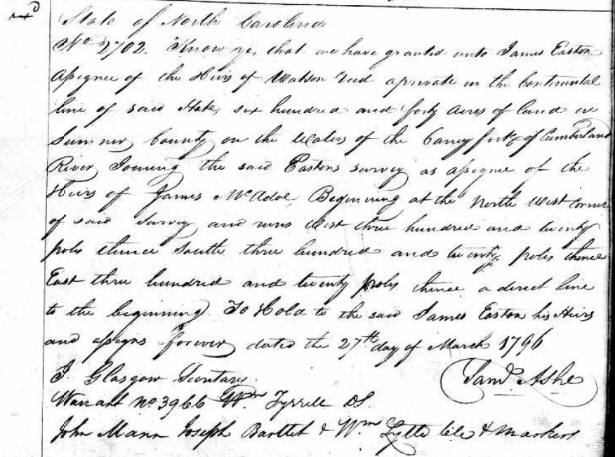
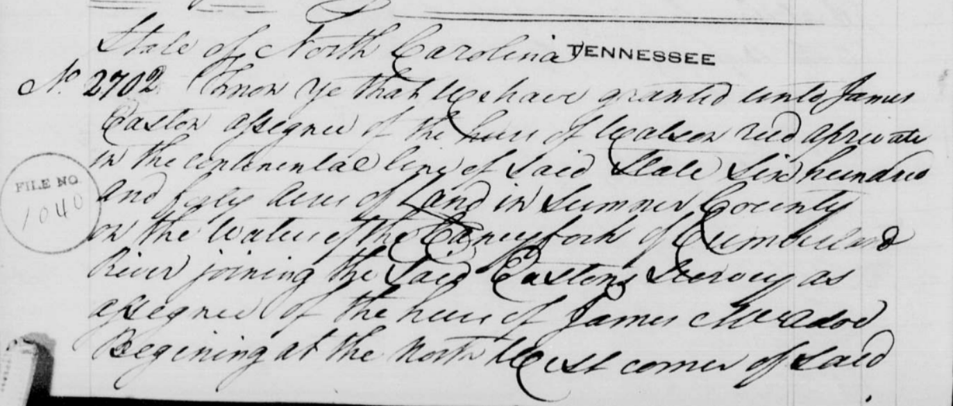
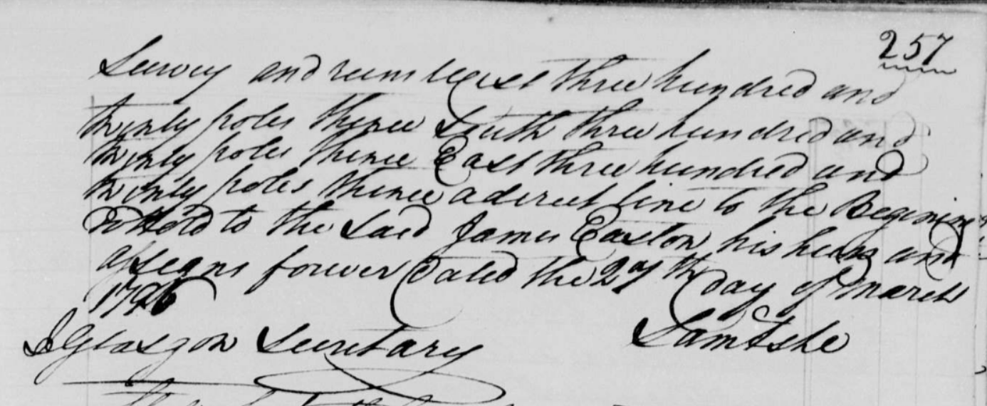
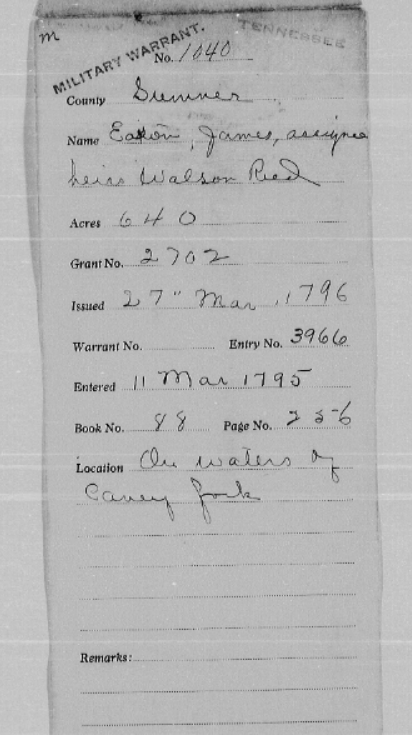
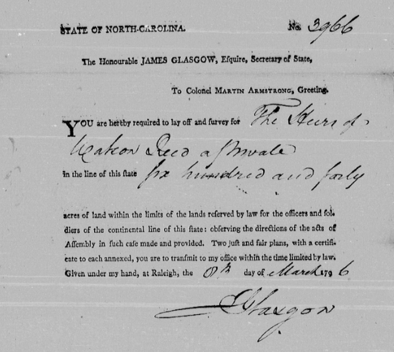
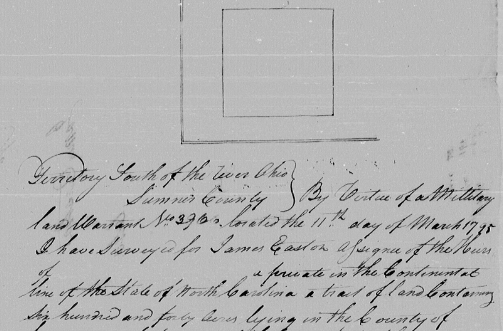
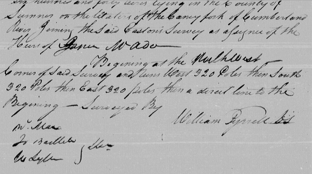
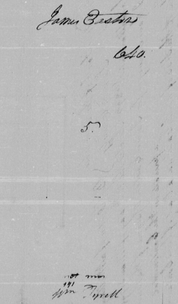
TN/NC Land Records, Book C-3, Page 327 - North Carolina to James Easton, 640 acres, 27 March 1796, Sumner County, TN, (White County had not yet been formed),
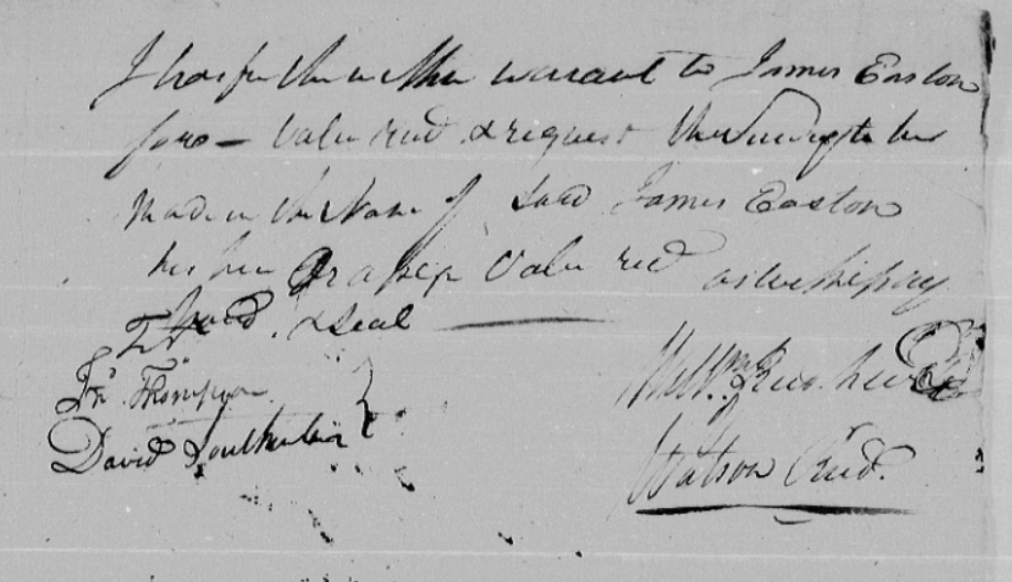
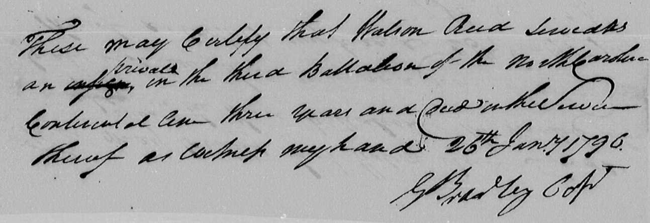
Easton was the assignee of the heirs of Watson Reed and may have paid the family of Watrow Reed some amount of money for it, bordered on the east by James Easton's
land granted as an assignee of James McAdoe. There are two versions of this grant, both pictured below. Interestingly, the patent is signed by Glasgow, who was
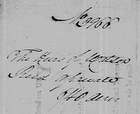
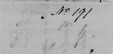
involved in land fraud around this time. The warrant/plat was entered 11 March 1795 as entry 3966. Below, after the first three images (two deeds), there are papers,
available from nclandgrants.com, that relate to Watson Reed and James Easton, as well as the original survey. This grant was the first time that an individual of
European origin could say that they owned this 640 acres, equivalent to one square mile.
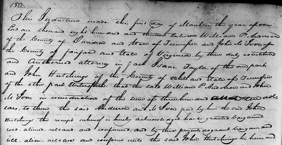
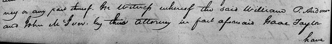
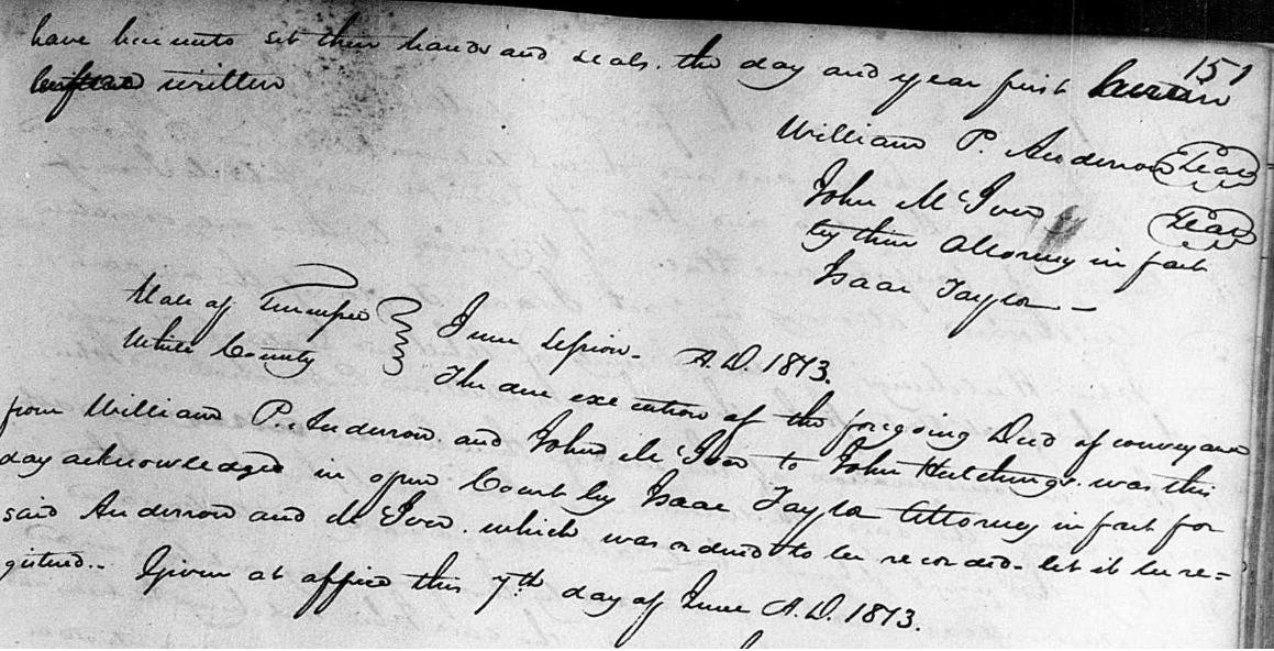
White County, TN, Deed Book E, Page 150 - William P. Anderson (Davidson County, TN) and John McIver (Fairfax County, VA) with their attorney, Isaac Taylor, to John
Hutchings with his attorney, 640 acres, 1 March 1813, Caney Fork River, the land had previously been granted to James Easton, an assignee of the heirs of Watson Reed,
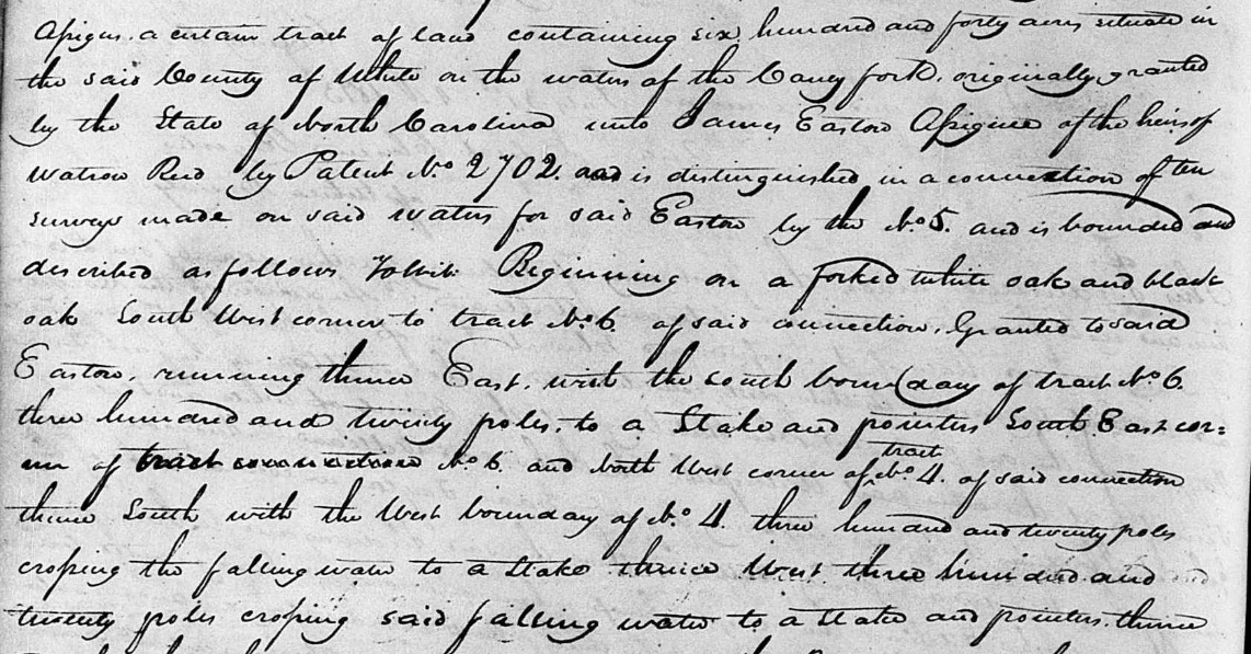
by patent number 2702. The land is No. 5 of a connection of ten surveys. Begins on a forked white oak and black oak, the SW corner of Tract No. 6, east with south
boundary of tract #6 320 poles to a stake and pointers, SE corner of tract #6 and NW corner of tract No. 4, south with the west boundary of tract #4, 320 poles,
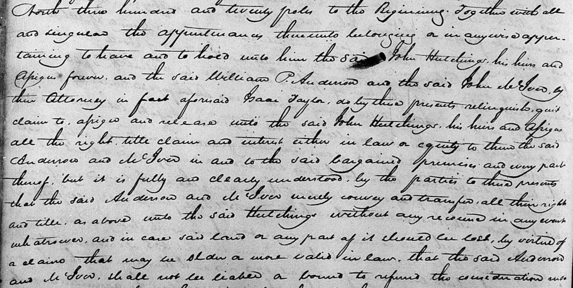
crossing the Falling Water to a stake, west 320 poles, crossing Falling Water to a stake and pointers, north 320 poles to the beginning.
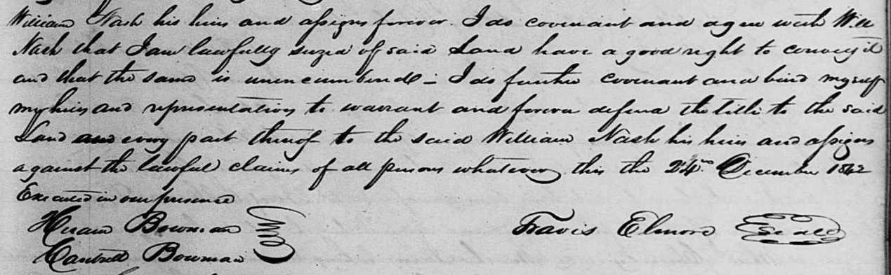
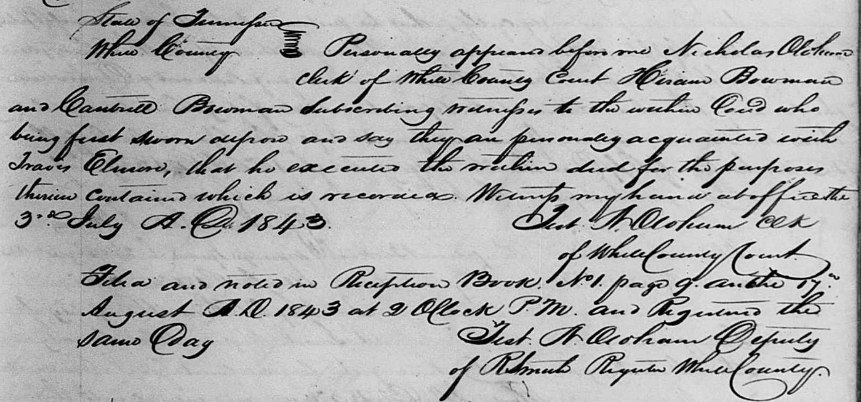
White County, TN, Deed Book N, Page 311 - Travis Elmore to William Nash, 138 acres, 24 December 1842, District 8, Falling Water, begins at the southeast corner of
a 640 acre tract conveyed from William P. Anderson and John McIver to John Hutchings and comprised the southeast corner, bounded by parts of the original southern
and eastern boundaries and the Falling Water, of the original 640 acre property. [Travis was in Jackson County in the 1840 census. The White/Jackson line was less
than a mile from Falling Water at one point. This proximity could explain why some of the deeds cannot be located because the Jackson County courthouse burned,
destroying most deeds and other documents that might have been recorded in that county. This also might be why some marriage records are not available as well.]

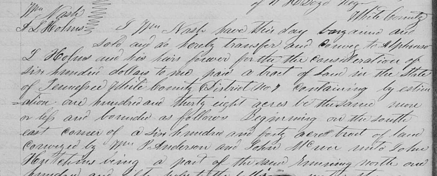
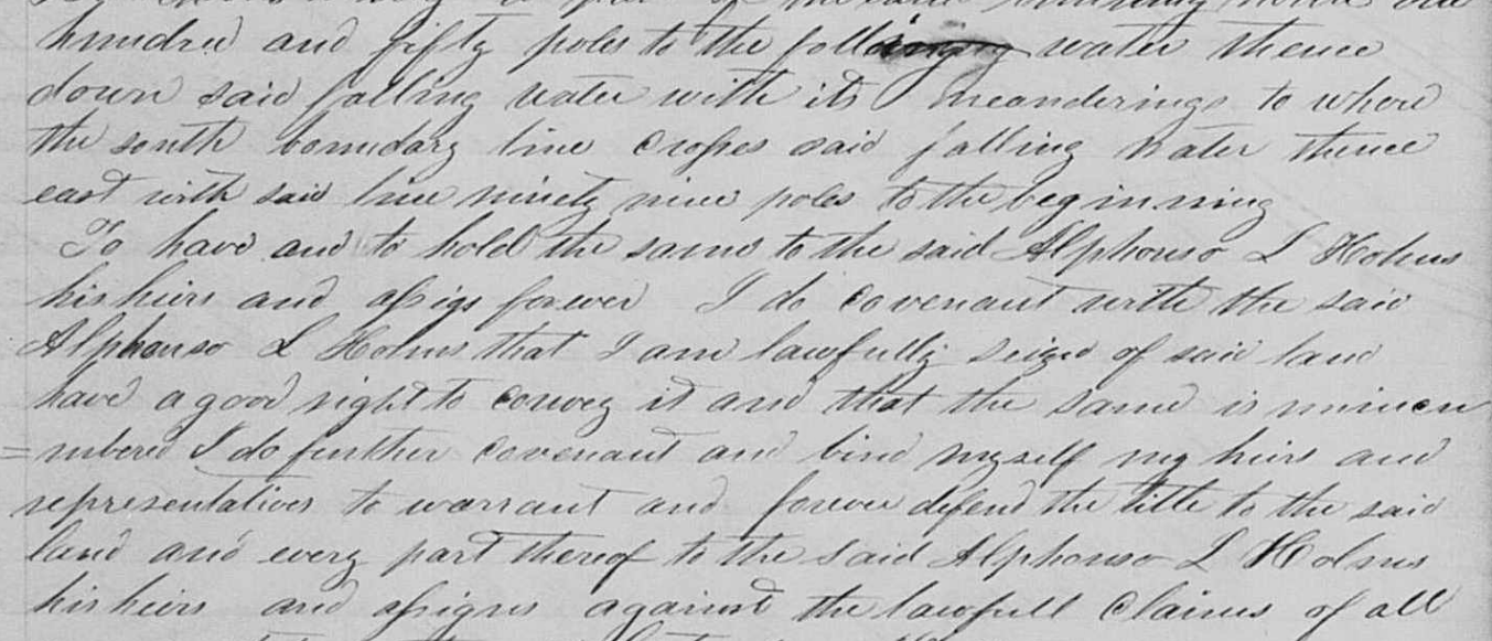
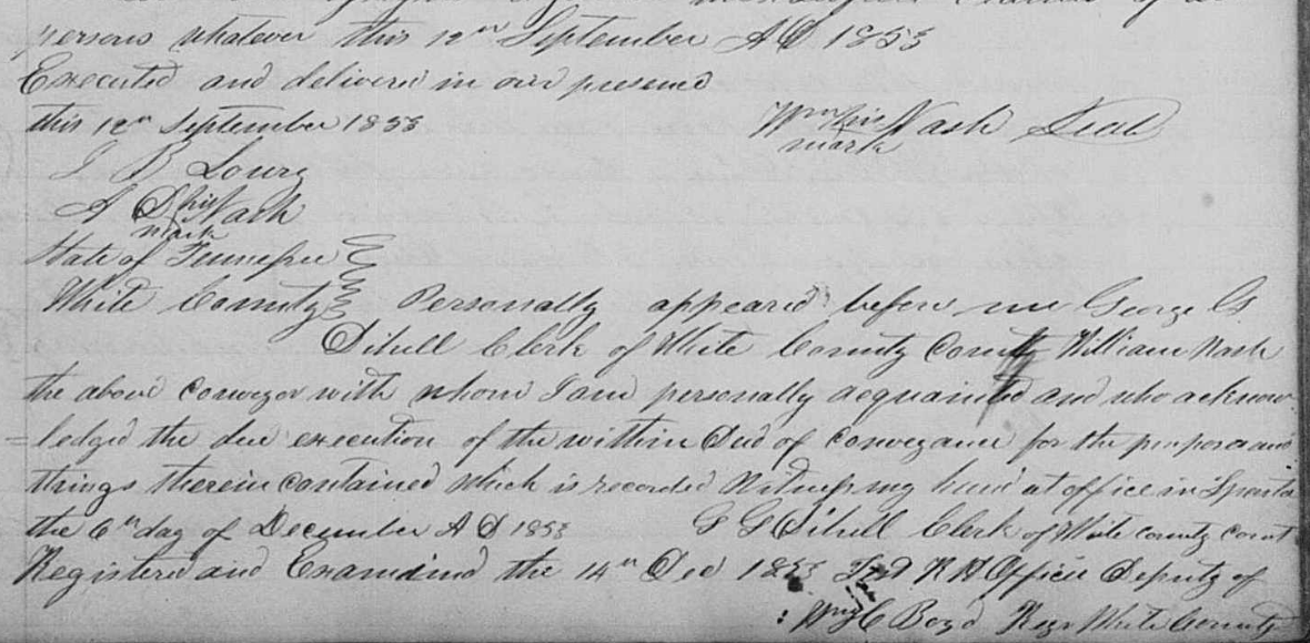
White County, TN, Deed Book R, Page 452, William Nash to Alphonso L. Holmes, 138 acres, 12 September 1853, District 7, Falling Water, began in the southeast
corner of a 640 acre tract conveyed from William P. Anderson and John McIver to John Hutchings and comprised the southeast corner, bounded by parts of the original
southern and eastern boundaries and the Falling Water, of the original 640 acre property.
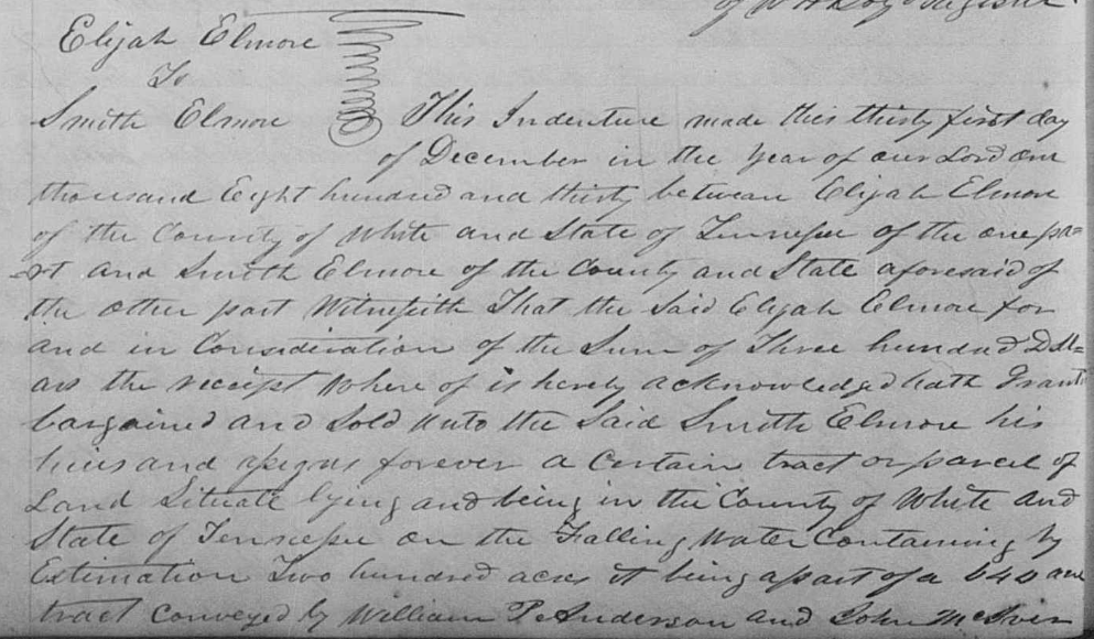
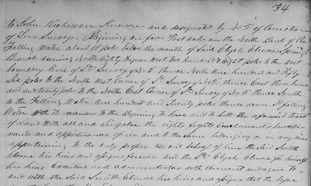
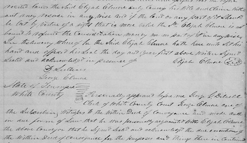
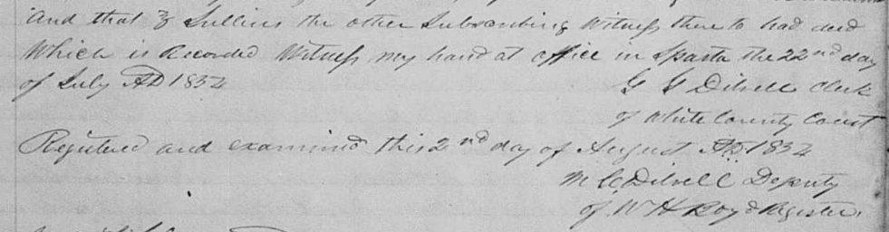
White County, TN, Deed Book S, Page 33 - Elijah Elmore to Smith Elmore, 200 acres, 31 December 1830, Falling Water, part of a 640 acre tract that had
previously been conveyed by William P. Anderson and John McIves to John Richerson. The full tract was known as No. 5 of a connnection of ten surveys. The line began
on four post oaks on the north bank of the Falling Water, about 15 poles below the mouth of Elijah Elmore's spring branch, N80W 208 poles to the west boundary of
#5, north 156 poles to the NW corner of #5, east 320 poles to the NE corner of #5, south 120 poles to the Falling Water, down the Falling Water to the beginning.
This land was at the top of survey 5. Witnesses were F. Sullins and George Elmore. [It is probable that this Smith Elmore was in the 1830 census with Elijah.]
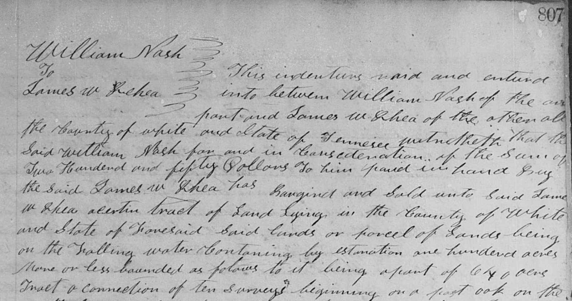
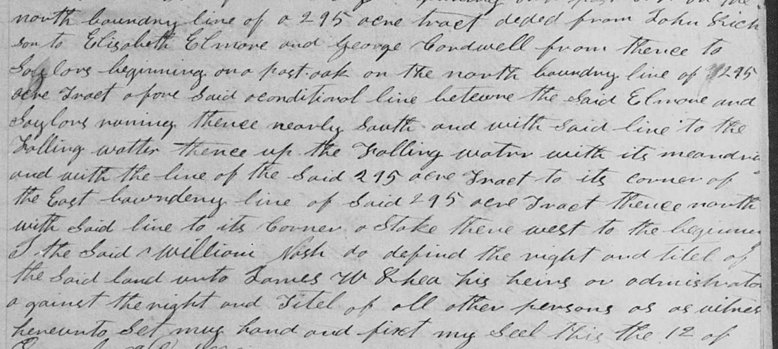
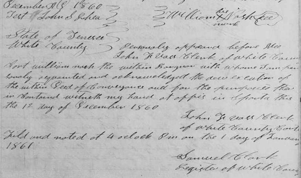
White County, TN, Deed Book T, Page 807 - William Nash to James W. Rhea, 100 acres, 12 December 1860, Falling Water River, part of a 640 acre tract, a connection of 10 surveys, begins on a post oak on the north boundary line of a 295 acre tract deeded from John Richerson to Elizabeth Elmore and George Cardwell, from thence to Saylors, begins on post oak on north line of the said 295 acre tract above the conditional line between Elmore and Saylors, nearly south and with said line to the Falling Water, up the Falling Water and with the line of the said 295 acre tract to its corner of the east line of said 295 acre tract, north with said line to its corner, a stake, west to the beginning. Witnessed by John S. Rhea. [Were Elmore and Cardwell related? It seems that the land was once owned by Saylors.]
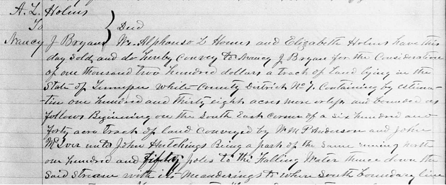
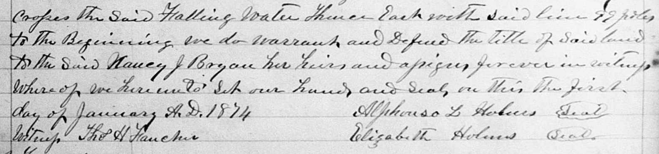
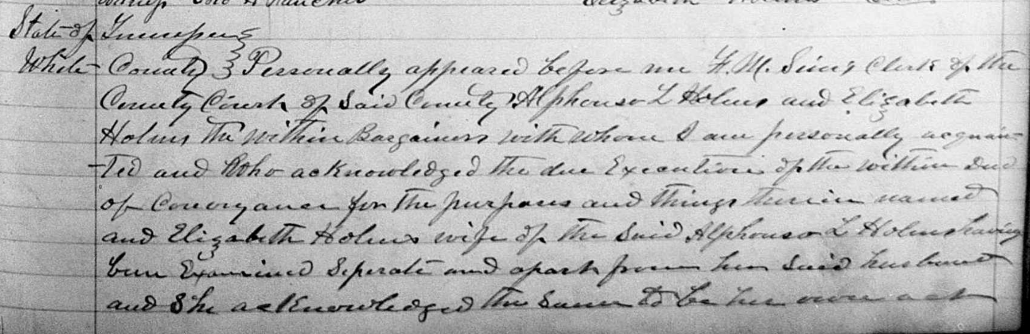
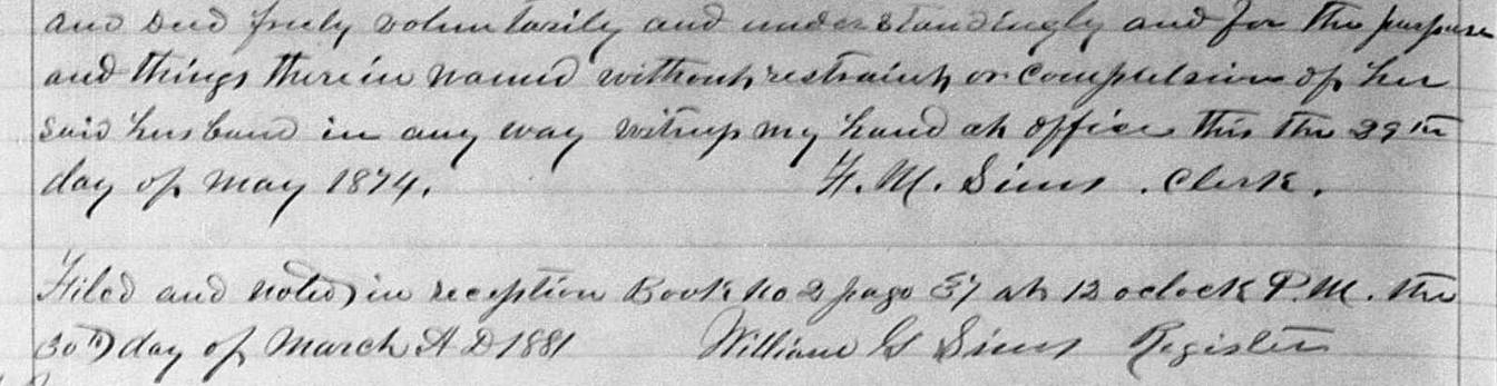
White County, TN, Deed Book 26, Page 405, Alphonso L. & Elizabeth Holmes to Nancy J. Bryan, 138 acres, 1 January 1874, District 7, Falling Water, began in the
southeast corner of a 640 acre tract conveyed from William P. Anderson and John McIver to John Hutchings and comprised the southeast corner, bounded by parts of
the original southern and eastern boundaries and the Falling Water, of the original 640 acre property. Witnessed by Thomas H. Fancher.
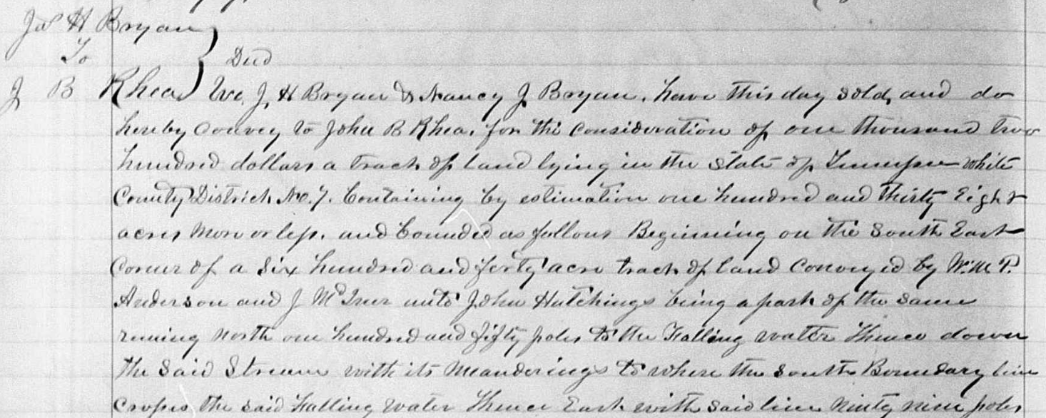
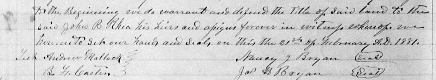
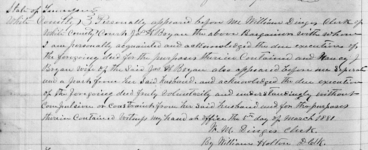
White County, TN, Deed Book 26, Page 406 - James H. & Nancy J. Bryan to John B. Rhea, 138 acres, 21 February 1881, District 7, Falling Water, began in the
southeast corner of a 640 acre tract conveyed from William P. Anderson and John McIver to John Hutchings and comprised the southeast corner, bounded by parts of
the original southern and eastern boundaries and the Falling Water, of the original 640 acre property. Witnessed by Andrew Matlock and B.F. Carter.

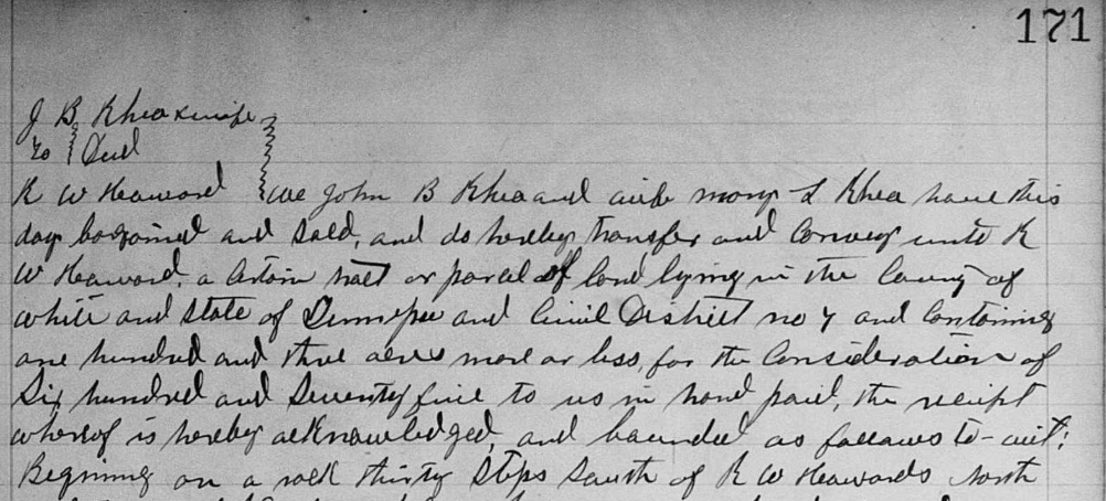
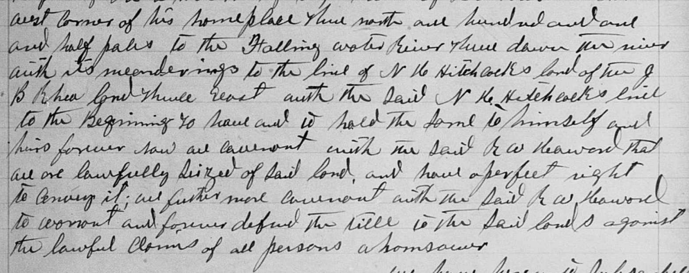
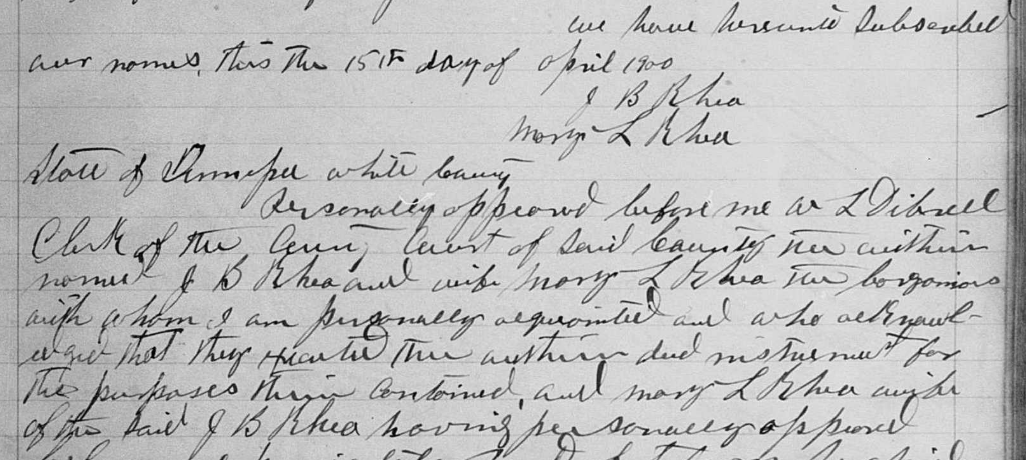
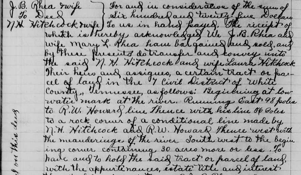
White County, TN, Deed Book 41, Page 171 - John B. & Mary T. Rhea to R.W. Howard, 103 acres, 15 April 1900, District 7, Falling Water, begins on a rock 30
steps south of the nortwest corner of Howard's homeplace" thence north 101.5 poles to Falling Water, down the river to the line of N.H. Hitchcock's land, of the
J.B. Rhea land, east with Hitchcock to the beginning. [It is likely that this is the land Rhea purchaed from Bryan above, selling off 103 of the 138 acres here to
Howard. I think this is Robert W. Howard who is buried in Howard cemetery near the White County airport.]
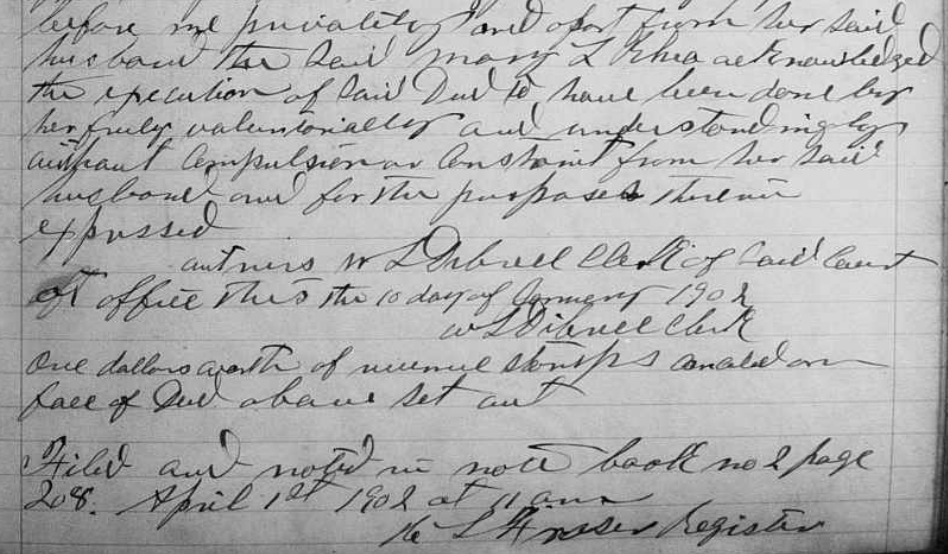
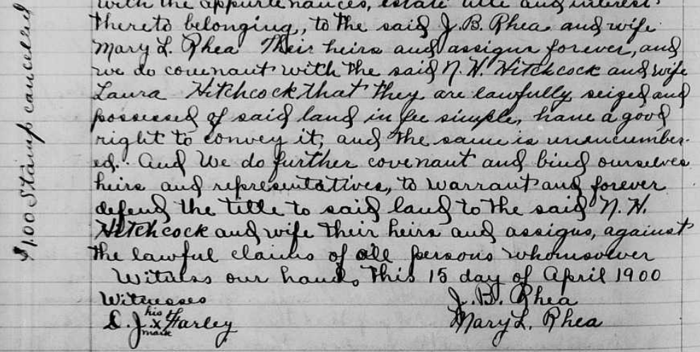
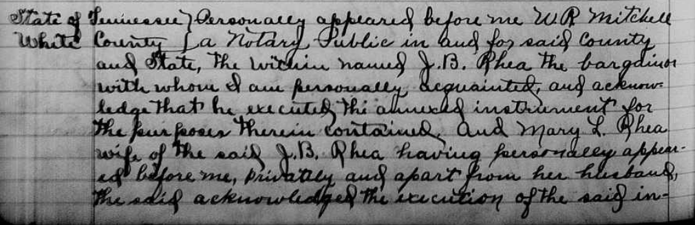
White County, TN, Deed Book 68, Page 454 - John B. & Mary L. Rhea to N.H. & Laura Hitchcock, 30 acres, 15 April 1900, District 7, Falling Water, begins at
low water mark at the river, east to R.W. Howard, with Howard to conditional line between Hitchcock and Howard, west with river, southwest to beginning. Witnessed
by D.J. Farley.
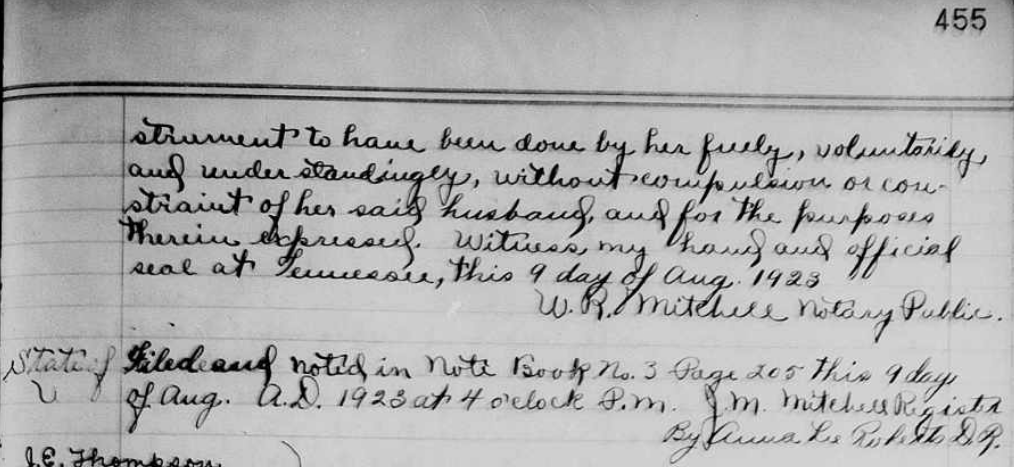
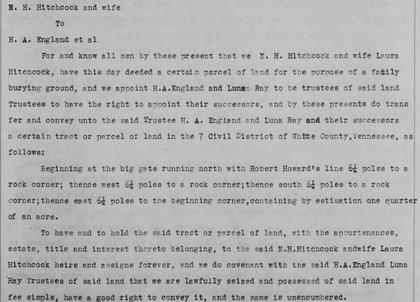
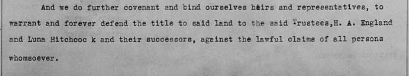
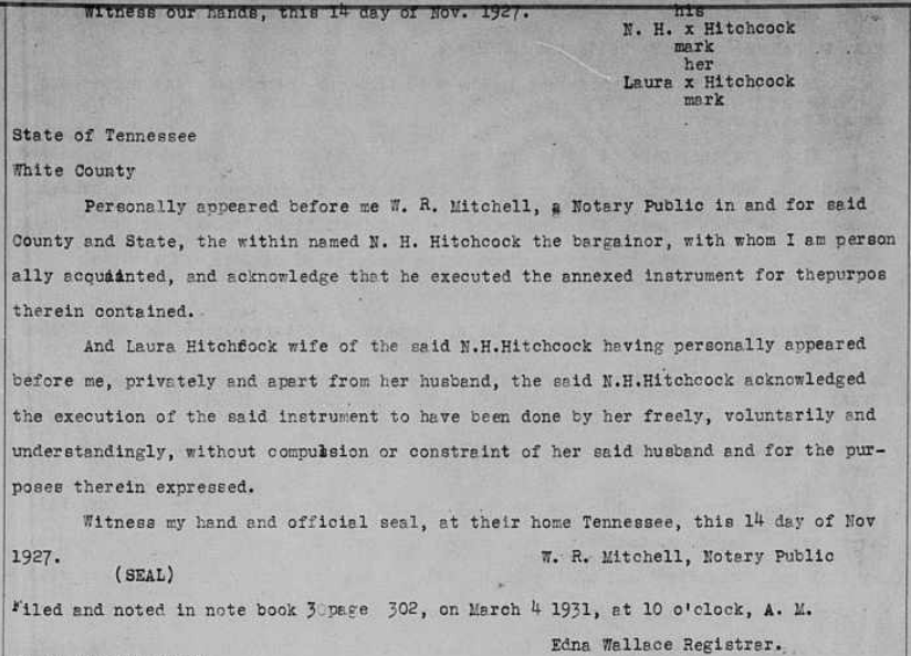
White County, TN, Deed Book 81, Page 13 - N.H. & Laura Hitchcock to H.A. England and Luna (Hitchcock) Ray as cemetery trustees, 0.25 acres, 14 November 1927,
District 7, begins at big gate, running north with Robert Howard to rock corner, west to rock corner, south to rock corner, east to the beginning.
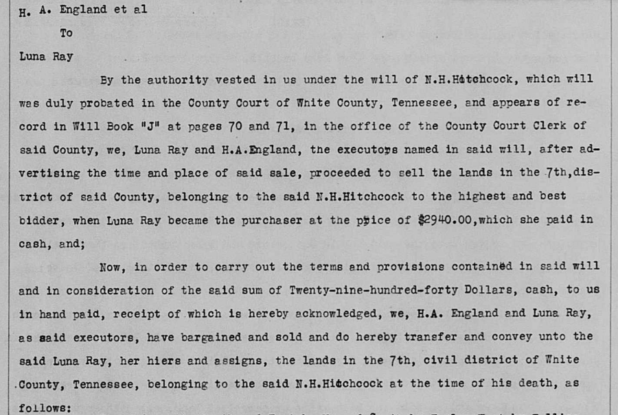
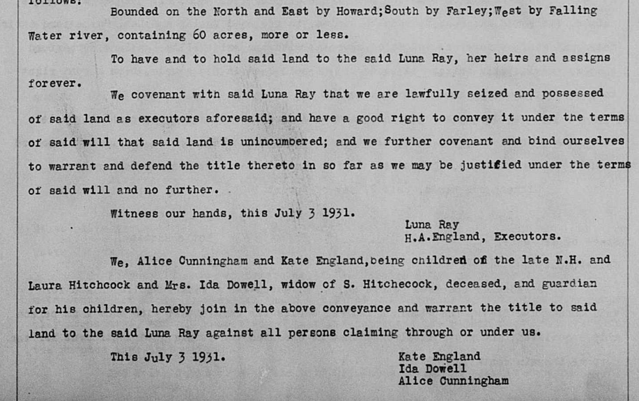
White County, TN, Deed Book 81, Page 163 - H.A. England, executor of the will of N.H. Hitchcock, to Luna Ray, 60 acres, 3 July 1931, Ray was the highest bidder,
District 7, bounded on the north and east by Howard, south by Farley, west by Falling Water. The auction was a result of the will of N.H. Hitchcock, probated in
White County and in Will Book J, pages 70-71, in the county clerk's office. Ray and England were the executors and advertised and organized the auction of the land.
This is the land the belonged to Hitchcock at the time of his death. Alice Cunningham and Kate England, children of N.H. and Laura Hitchcock, joined the conveyance,
as did Ida Dowell, widow of S. Hitchcock and guardian of his children. [I think S is Storm Hitchcock.]

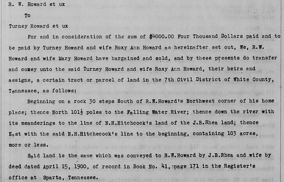
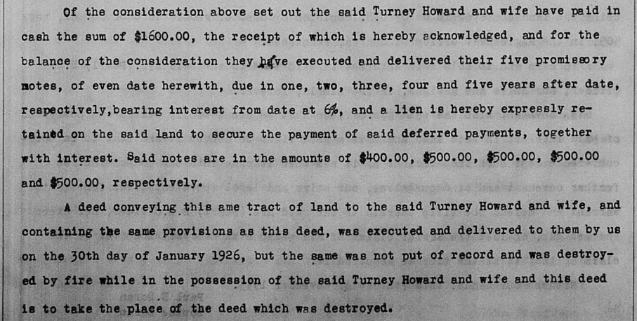
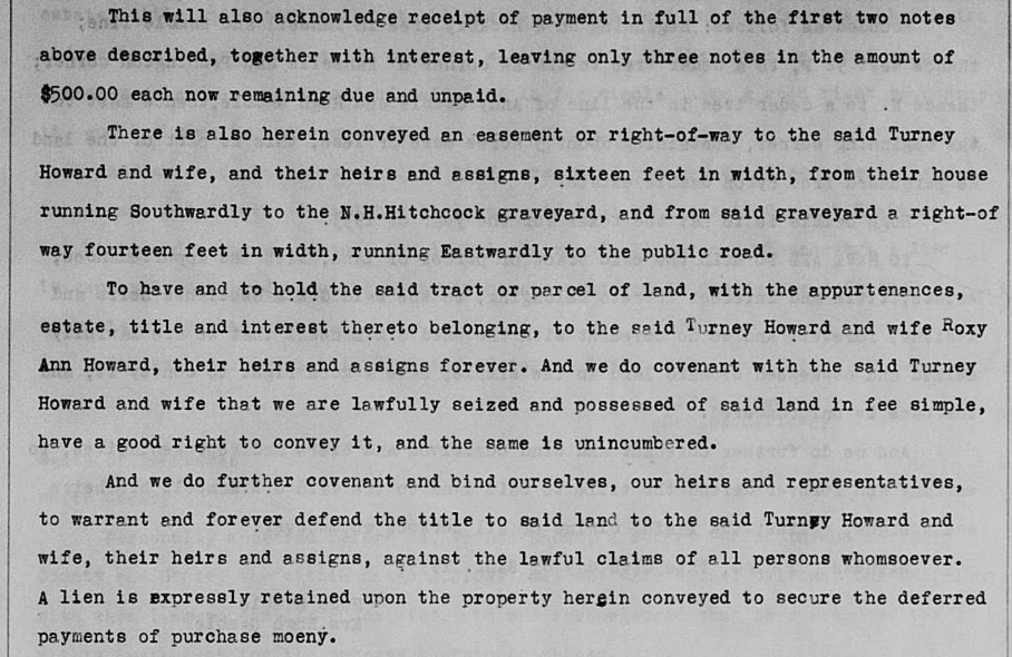
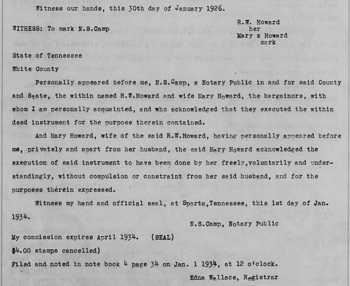
White County, TN, Deed Book 83, Page 200 - R.W. & Mary Howard to Turney & Roxy Ann Howard, 103 acres, 30 January 1926, district 7, Falling Water, Begins on
a rock 30 steps south of the nortwest corner of Howard's homeplace" thence north 101.5 poles to Falling Water, down the river to the line of N.H. Hitchcock's
land, of the J.B. Rhea land, east with Hitchcock to the beginning. This includes a right of way related to the N.H. Hitchcock graveyard.